Oceanography and the Eye in the Sky: Unveiling the Impact of Satellite Technology on Our Oceans
- Global Ocean Observation Market: Scope and Dynamics
- Emerging Satellite Technologies Shaping Oceanographic Research
- Key Players and Strategic Moves in Satellite Oceanography
- Projected Expansion and Investment Trends in Ocean Data Solutions
- Regional Perspectives: Satellite Oceanography Across Continents
- Next-Generation Opportunities in Ocean Monitoring from Space
- Barriers and Breakthroughs: Navigating the Future of Satellite Oceanography
- Sources & References
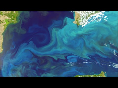
“Rare Hydrological Phenomenon in Australia Captured by Satellite” (source)
Global Ocean Observation Market: Scope and Dynamics
Satellites have revolutionized the field of oceanography, providing unprecedented, real-time insights into the world’s oceans. The integration of satellite technology into ocean observation has expanded the scope of data collection, enabling scientists and policymakers to monitor vast and remote marine areas with high temporal and spatial resolution. This technological leap is a key driver in the global ocean observation market, which was valued at approximately USD 1.7 billion in 2023 and is projected to reach USD 2.5 billion by 2028, growing at a CAGR of 7.8%.
Satellites equipped with advanced sensors can measure a range of oceanographic parameters, including sea surface temperature, salinity, chlorophyll concentration, sea level, and ocean color. These measurements are critical for understanding climate change, tracking marine pollution, supporting fisheries management, and improving weather forecasting. For example, the GRACE and Sentinel-3 missions provide continuous data on sea level rise and ocean currents, informing both scientific research and policy decisions.
The dynamic nature of satellite-based ocean observation is further enhanced by the proliferation of small satellites (CubeSats) and commercial satellite constellations. These innovations have reduced the cost and increased the frequency of data collection, making oceanographic information more accessible to a broader range of stakeholders. According to the European Space Agency, the Sentinel-6 Michael Freilich satellite, launched in 2020, delivers high-precision measurements of global sea level, supporting climate monitoring and disaster response efforts.
- Global Coverage: Satellites provide near-global coverage, overcoming the limitations of ship-based and buoy observations.
- Real-Time Data: Rapid data transmission enables timely responses to environmental events such as oil spills, algal blooms, and hurricanes.
- Data Integration: Satellite data is increasingly integrated with in-situ measurements and artificial intelligence, enhancing predictive modeling and decision-making.
As the demand for accurate, timely ocean data grows—driven by climate change, maritime security, and sustainable resource management—satellite-based observation systems are set to play an even more central role in the global ocean observation market. The synergy between technological innovation and market demand is expected to accelerate, redefining how humanity understands and manages the oceans.
Emerging Satellite Technologies Shaping Oceanographic Research
Satellites have revolutionized oceanographic research, providing unprecedented, real-time insights into the world’s oceans. Traditionally, oceanography relied on ship-based surveys and stationary buoys, which, while valuable, offered limited spatial and temporal coverage. Today, satellite technologies deliver global, continuous, and high-resolution data, fundamentally transforming our understanding of ocean dynamics, climate change, and marine ecosystems.
Modern satellites equipped with advanced sensors can monitor a wide array of oceanographic parameters. For instance, NASA’s Jason-3 and the European Space Agency’s Sentinel-6 satellites measure sea surface height with centimeter-level accuracy, enabling scientists to track sea level rise and ocean circulation patterns. The Sentinel-3 mission provides data on sea surface temperature, ocean color, and surface topography, which are critical for monitoring marine heatwaves, algal blooms, and primary productivity.
Emerging satellite technologies are pushing the boundaries even further. The Surface Water and Ocean Topography (SWOT) mission, launched in December 2022, is the first to provide high-resolution mapping of ocean surface currents and eddies at scales previously unobservable from space. This data is vital for understanding heat and carbon transport, as well as for improving weather and climate models.
- Real-time Monitoring: Satellites now deliver near real-time data, crucial for disaster response, such as tracking oil spills or harmful algal blooms (NOAA).
- Climate Change Insights: Long-term satellite records have revealed that global mean sea level has risen by about 3.3 mm per year since 1993 (NASA Sea Level).
- Marine Ecosystem Health: Ocean color sensors, like those on MODIS and Sentinel-3, help monitor phytoplankton blooms, a key indicator of ocean health and fisheries productivity.
As satellite technology continues to advance, the integration of artificial intelligence and machine learning is expected to further enhance data analysis and predictive capabilities. These “eyes in the sky” are not only redefining how we study the oceans but are also essential for managing and protecting marine resources in a rapidly changing world.
Key Players and Strategic Moves in Satellite Oceanography
Satellite technology has revolutionized the field of oceanography, providing unprecedented insights into the dynamics of the world’s oceans. The integration of remote sensing, high-resolution imaging, and real-time data transmission has enabled scientists and policymakers to monitor oceanic phenomena with remarkable accuracy and frequency. This transformation is driven by a combination of public agencies, private companies, and international collaborations, each playing a pivotal role in advancing satellite oceanography.
- NASA and ESA: The NASA and the European Space Agency (ESA) are at the forefront, operating flagship missions such as the Sentinel-6 Michael Freilich and Jason series. These satellites provide critical data on sea level rise, ocean currents, and climate change, supporting both scientific research and policy development.
- NOAA: The National Oceanic and Atmospheric Administration (NOAA) leverages its GOES and JPSS satellite fleets to deliver near-real-time oceanographic data, including sea surface temperature, ocean color, and hurricane tracking. NOAA’s data is integral to weather forecasting and disaster response.
- Private Sector Innovation: Companies like Planet Labs and Maxar Technologies are expanding the commercial landscape by offering high-frequency, high-resolution imagery. Their data services support applications ranging from fisheries management to maritime security and environmental monitoring.
- International Collaboration: Initiatives such as the Copernicus Programme and the Global Ocean Observing System (GOOS) exemplify the collaborative approach to satellite oceanography. These partnerships pool resources and expertise, ensuring comprehensive global coverage and data accessibility.
Strategically, the sector is witnessing a surge in public-private partnerships and data-sharing agreements. For example, the NASA-NOAA partnership on the Sentinel-6 mission exemplifies how agencies are joining forces to address global challenges. Meanwhile, the proliferation of small satellites and constellations is democratizing access to oceanographic data, enabling emerging economies and research institutions to participate in ocean monitoring.
As of 2024, the global satellite oceanography market is projected to grow at a CAGR of 7.2% through 2030, driven by climate change monitoring, maritime security, and the blue economy (MarketsandMarkets). The convergence of advanced satellite platforms, AI-driven analytics, and open data policies is set to further redefine how humanity observes and manages the oceans from space.
Projected Expansion and Investment Trends in Ocean Data Solutions
Satellites have become indispensable tools in modern oceanography, offering unprecedented insights into the world’s oceans. The integration of satellite technology—often referred to as the “eye in the sky”—is driving a new era of data-driven marine science, with significant implications for investment and market expansion in ocean data solutions.
According to the Euroconsult, the global satellite-based Earth observation market is projected to reach $7.5 billion by 2031, up from $4.6 billion in 2021. A substantial portion of this growth is attributed to ocean monitoring applications, including sea surface temperature, chlorophyll concentration, sea level rise, and maritime traffic surveillance. The demand for high-resolution, real-time ocean data is being fueled by climate change concerns, regulatory requirements, and the expansion of the blue economy.
Key players such as Maxar Technologies, Planet Labs, and EUMETSAT are investing heavily in next-generation satellite constellations and data analytics platforms. These investments are enabling more frequent and detailed observations, which are critical for applications ranging from fisheries management to disaster response. For example, the Copernicus Programme by the European Union provides free and open access to oceanographic data, supporting both public and private sector innovation.
- Investment Trends: Venture capital and government funding in ocean data startups have surged. In 2023, ocean technology startups raised over $1.2 billion globally, with a significant share directed toward satellite-enabled solutions (Startup Insight).
- Market Expansion: The market for ocean data solutions is expected to grow at a CAGR of 12.5% through 2030, driven by the proliferation of satellite data and the need for actionable intelligence in sectors such as shipping, offshore energy, and environmental monitoring (MarketsandMarkets).
- Emerging Applications: New uses for satellite oceanography include carbon sequestration monitoring, illegal fishing detection, and coastal resilience planning, further broadening the scope for investment and innovation.
In summary, satellites are redefining oceanography by providing scalable, cost-effective, and timely data. This technological shift is catalyzing robust investment and rapid market expansion in ocean data solutions, positioning the sector for sustained growth in the coming decade.
Regional Perspectives: Satellite Oceanography Across Continents
Satellite oceanography has revolutionized the way scientists, policymakers, and industries understand and manage the world’s oceans. By providing a global, real-time perspective, satellites enable the monitoring of vast and remote marine areas that would otherwise be inaccessible. This technological leap is reshaping oceanographic research and resource management across continents, with each region leveraging satellite data to address unique environmental and economic challenges.
In North America, agencies like NASA and NOAA utilize satellites such as the Jason-3 to track sea level rise, ocean currents, and temperature anomalies. These data are critical for hurricane forecasting, fisheries management, and understanding climate change impacts along the Atlantic and Pacific coasts.
Europe leads with the Copernicus Programme, particularly the Sentinel satellites, which provide high-resolution imagery and ocean color data. This information supports marine spatial planning, pollution tracking, and the monitoring of harmful algal blooms in the Mediterranean and North Sea.
In Asia-Pacific, countries like China, Japan, and India have launched their own ocean observation satellites. For example, China’s HY-1 series and India’s Oceansat missions provide vital data for monsoon prediction, fisheries, and disaster response in the Indian and Pacific Oceans.
Africa is increasingly benefiting from international satellite data-sharing initiatives. Programs like GMES & Africa help monitor coastal erosion, illegal fishing, and marine pollution, supporting sustainable development along the continent’s extensive coastlines.
In South America, Brazil’s INPE and regional collaborations use satellite data to monitor the South Atlantic, track oil spills, and manage marine protected areas.
Globally, the integration of satellite oceanography is fostering a new era of data-driven decision-making. According to the UN Decade of Ocean Science, satellite-derived data is essential for achieving sustainable ocean management and addressing climate change. As satellite technology advances, its role in redefining our understanding of the oceans will only deepen, offering unprecedented insights for every continent.
Next-Generation Opportunities in Ocean Monitoring from Space
Satellites have revolutionized the field of oceanography, providing unprecedented, real-time insights into the world’s oceans. Traditional ocean monitoring relied heavily on ships, buoys, and coastal stations, which, while valuable, offered limited spatial and temporal coverage. Today, satellite-based remote sensing delivers global, continuous, and high-resolution data, enabling scientists and policymakers to better understand and manage marine environments.
Modern satellites equipped with advanced sensors can measure a wide array of oceanographic parameters. These include sea surface temperature, chlorophyll concentration, sea level, salinity, ocean color, and even the movement of currents and eddies. For example, the European Space Agency’s Copernicus Sentinel-3 mission provides high-accuracy measurements of sea surface temperature and color, supporting climate research and fisheries management (ESA Sentinel-3).
One of the most significant advancements is the ability to monitor ocean health and productivity. Satellite data helps track harmful algal blooms, coral bleaching events, and the spread of marine pollution, such as oil spills and plastic debris. NASA’s MODIS (Moderate Resolution Imaging Spectroradiometer) and the upcoming PACE (Plankton, Aerosol, Cloud, ocean Ecosystem) mission are at the forefront of these efforts, providing critical data for early warning systems and environmental management (NASA PACE).
Sea level rise, a key indicator of climate change, is now monitored with millimeter precision by satellite altimeters like those on the Jason-3 and Sentinel-6 Michael Freilich missions. According to the latest data, global mean sea level has risen by about 3.3 mm per year since 1993 (NASA Sea Level Change), information vital for coastal planning and disaster preparedness.
Looking ahead, next-generation satellite missions are poised to further enhance ocean monitoring capabilities. Technologies such as synthetic aperture radar (SAR), hyperspectral imaging, and constellations of small satellites (CubeSats) promise higher resolution, more frequent observations, and new data types. These innovations will support sustainable fisheries, marine biodiversity conservation, and the blue economy, while also improving our ability to respond to natural disasters and climate impacts (Nature: Ocean Monitoring from Space).
In summary, satellites are redefining oceanography by providing comprehensive, actionable data on the state of the oceans. As technology advances, the “eye in the sky” will play an increasingly central role in safeguarding marine resources and understanding the planet’s most dynamic environment.
Barriers and Breakthroughs: Navigating the Future of Satellite Oceanography
Satellite technology has revolutionized the field of oceanography, providing unprecedented insights into the vast and dynamic marine environment. Traditionally, oceanographic data collection relied on ships, buoys, and underwater sensors, which, while valuable, offered limited spatial and temporal coverage. The advent of Earth-observing satellites has transformed this landscape, enabling scientists to monitor the oceans on a global scale in near real-time.
Modern satellites equipped with advanced sensors can measure a wide array of oceanographic parameters, including sea surface temperature, salinity, chlorophyll concentration, sea level, and ocean currents. For example, the GRACE and Jason-3 missions have provided critical data on sea level rise and ocean circulation patterns, informing climate models and coastal management strategies. The Sentinel-3 satellite, part of the European Copernicus program, delivers high-resolution measurements of sea surface temperature and color, supporting marine ecosystem monitoring and fisheries management.
Despite these breakthroughs, several barriers remain. Cloud cover, for instance, can obscure optical sensors, limiting the accuracy of some measurements. Additionally, the vast volume of data generated by satellites poses challenges for storage, processing, and analysis. There are also gaps in coverage for certain parameters, such as subsurface ocean properties, which still require in situ measurements for validation and calibration (Nature).
Recent technological advances are addressing some of these challenges. The integration of artificial intelligence and machine learning is enhancing the interpretation of satellite data, enabling faster and more accurate detection of ocean phenomena such as algal blooms and oil spills (ESA). New satellite missions, like NASA’s Surface Water and Ocean Topography (SWOT), promise to deliver even finer-scale observations of ocean surface dynamics, opening new frontiers in our understanding of ocean processes.
As satellite oceanography continues to evolve, it is poised to play a central role in addressing global challenges such as climate change, marine resource management, and disaster response. The synergy between satellite and in situ observations, coupled with advances in data analytics, will be key to unlocking the full potential of the “eye in the sky” for ocean science.
Sources & References
- Oceanography and the Eye in the Sky: How Satellites Are Redefining Our Oceans
- MarketsandMarkets
- Jason-3
- EUMETSAT
- HY-1 series
- ESA
- NASA Sea Level
- MODIS
- Jason-3
- Planet Labs
- Maxar Technologies
- Copernicus Programme
- Global Ocean Observing System (GOOS)
- Euroconsult
- Oceansat
- UN Decade of Ocean Science
- NASA PACE
- NASA Sea Level Change
- Nature
- Sentinel-3